OHV Trail Map California 6.0
Free Version
Publisher Description
The CTUC OHV Trail Map California app provides in-app access to the entire line of OHV maps from the California Trail Users Coalition.
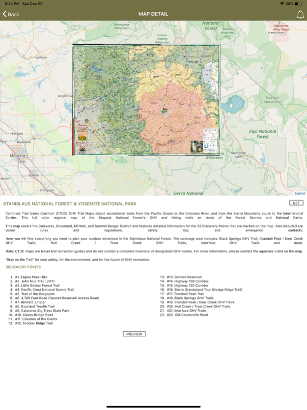
View the map in several zoom levels and navigate to popular destinations throughout California. The map covers 85 million acres of world-class OHV recreation lands from the sand dunes in the desert to the forests in the mountains, from the Colorado River to the Pacific Ocean. Depicted on the map are thousands of miles of legal, designated OHV roads and trails, as well as OHV Open Areas, wilderness areas, State Parks, military bases, and other public and private lands.
The map features backcountry motor vehicle routes designated by the BLM, USFS, NPS and other land management agencies.
Featured within the app are:
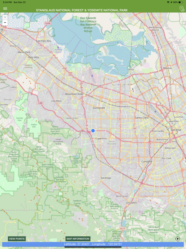
√ Street level background layer can be turned on or off
√ Zoom and scroll across the map
√ Find your location (iPhones and cellular iPads only)
√ Track your movement across the map (iPhones and cellular iPads only)
√ Find and navigate to hundreds of back country destinations and points of interests
√ Obtain emergency and other contacts
√ Find local services such as fuel, lodging and food
√ Learn area OHV rules, regulations, and safety tips
√ Legend of symbols on the map
Mar 3, 2020
Version 6.0
bug fixes
About OHV Trail Map California
OHV Trail Map California is a free app for iOS published in the Recreation list of apps, part of Home & Hobby.
The company that develops OHV Trail Map California is Friends of Jawbone. The latest version released by its developer is 6.0.
To install OHV Trail Map California on your iOS device, just click the green Continue To App button above to start the installation process. The app is listed on our website since 2020-03-03 and was downloaded 0 times. We have already checked if the download link is safe, however for your own protection we recommend that you scan the downloaded app with your antivirus. Your antivirus may detect the OHV Trail Map California as malware if the download link is broken.
How to install OHV Trail Map California on your iOS device:
- Click on the Continue To App button on our website. This will redirect you to the App Store.
- Once the OHV Trail Map California is shown in the iTunes listing of your iOS device, you can start its download and installation. Tap on the GET button to the right of the app to start downloading it.
- If you are not logged-in the iOS appstore app, you'll be prompted for your your Apple ID and/or password.
- After OHV Trail Map California is downloaded, you'll see an INSTALL button to the right. Tap on it to start the actual installation of the iOS app.
- Once installation is finished you can tap on the OPEN button to start it. Its icon will also be added to your device home screen.
